


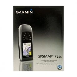


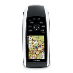
Garmin GPSMAP 78SC Handheld Colour GPS
Original price was: $418.00.$97.99Current price is: $97.99.
- Fast and Secure Payments
- High quality products, low prices.
- We take quality seriously.
- Quality You Can Trust


Navigate anywhere with ease
Perfect for boaters and water sports enthusiasts who want to run
with the best, the rugged Garmin GPSMAP 78SC Handheld
Colour GPS features a 3-axis compass, barometric
altimeter, crisp colour mapping, high-sensitivity receiver, new
moulded rubber side grips, plus a microSD card slot for loading
additional maps. And it floats! The GPSMAP 78SC comes complete with
a chart card so you’re good to go!
Explore
The GPSMAP 78s comes with built-in worldwide basemap, so you can
navigate anywhere with ease. And like the rest of the 78-series,
78s is IPX7 waterproof and even floats in water.
Get Your Bearings
The GPSMAP 78s has a built-in 3-axis tilt-compensated electronic
compass, which shows your heading even when you’re standing still
without holding it level. Its barometric altimeter tracks changes
in pressure to pinpoint your precise altitude, and you can even use
it to plot barometric pressure over time, which can help you keep
an eye on changing weather conditions.
Share Wirelessly
With the GPSMAP 78s you can share your waypoints, tracks, routes
and geocaches wirelessly other compatible device users. Now you can
send the location of your favourite fishing spot to a friend to
find. Sharing data is easy. Just press “send” to transfer your
information to similar units.
Garmin GPSMAP 78S Handheld Colour GPS
Features:
- Worldwide shaded relief basemap
- MicroSD card slot for optional mapping
- 3-Axis compass & barometric altimeter
- Floats, buoyant
- 2.6-inch TFT LCD display
- Worldwide shaded relief basemap; microSD card slot for optional
mapping - 3-Axis compass & barometric altimeter
- Floats, buoyant
- Built-in 3-axis electronic compass; Barometric
altimeter - 1.7MB built-in memory
Garmin GPSMAP 78S Handheld Colour GPS
Specifications:
Physical & Performance:
- Unit dimensions: 2.6″ x 6.0″ x 1.2″ (6.6 x 15.2 x 3.0 cm)
(WxHxD) - Display size: 1.43″ x 2.15″ (3.6 x 5.5 cm); 2.6″ diag (6.6 cm)
(WxH) - Display resolution: 160 x 240 pixels (WxH)
- Display type: transflective, 65-K colour TFT
- Weight: 7.7 oz (218.3 g) with batteries
- Battery: 2 AA batteries (not included); NiMH or Lithium
recommended - Battery life: 20 hours
- Waterproof: yes (IPX7)
- Floats: yes
- High-sensitivity receiver: yes
- Interface: high-speed USB and NMEA 0183 compatible
Maps and Memory:
- Basemap: yes
- Preloaded maps: no
- Ability to add maps: yes
- Built-in memory: 1.7 GB
- Accepts data cards: microSD™ card (not included)
- Waypoints/favourites/locations: 2000
- Routes: 200
- Track log: 10,000 points, 200 saved tracks
Features and Benefits:
- Automatic routing (turn by turn routing on roads): yes (with
optional mapping for detailed roads) - Electronic compass: yes (tilt-compensated, 3-axis)
- Touchscreen: no
- Barometric altimeter: yes
- Camera: no
- Geocaching-friendly: yes (paperless)
- Custom maps compatible: yes
- Photo navigation (navigate to geotagged photos): yes
- Hunt/fish calendar: yes
- Sun and moon information: yes
- Tide tables: yes
- Area calculation: yes
- Custom POIs (ability to add additional points of interest):
yes - Unit-to-unit transfer (shares data wirelessly with similar
units): yes - Picture viewer: yes
- Garmin Connect compatible (online community where you analyse,
categorize and share data): yes
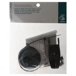
What’s in the Box:
- GPSMAP 78s
- Bluewater chart
- Wrist strap
- USB cable
- Manual
Garmin GPSMAP 78S Handheld Colour GPS User Manuals
Be the first to review “Garmin GPSMAP 78SC Handheld Colour GPS”
Related products


Reviews
There are no reviews yet.