


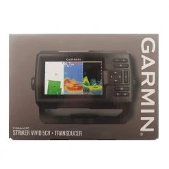
Garmin GPSMAP 78 Handheld GPS
Original price was: $439.00.$97.99Current price is: $97.99.
- Fast and Secure Payments
- High quality products, low prices.
- We take quality seriously.
- Quality You Can Trust


Colourful maps, durable design and buoyant — everything a
mariner needs
For boaters and water sports enthusiasts who want to run with the
best, the rugged Garmin GPSMAP 78 Handheld GPS
features crisp colour mapping, high-sensitivity receiver, new
moulded rubber side grips, plus a microSD card slot for loading
additional maps. And it floats!
Keep Your Fix
With its high-sensitivity, WAAS-enabled GPS receiver and HotFix
satellite prediction, GPSMAP 78 locates your position quickly and
precisely and maintains its GPS location even in heavy cover and
deep canyons. The advantage is clear — whether you’re in deep woods
or just near tall buildings and trees, you can count on GPSMAP 78
to help you find your way when you need it the most.
Add Maps
Adding more maps is easy with Garmin’s wide array of detailed
marine, topographic and road maps, available on microSD card.
Conveniently plug in BlueChart g2 preloaded cards for a great day
on the water or City Navigator NT map data for turn-by-turn routing
on roads (see maps tab for compatible maps). The card slot is
located inside the waterproof battery compartment, so you don’t
have to worry about getting it wet. GPSMAP 78 also supports
BirdsEye Satellite Imagery (subscription required), that lets you
download satellite images to your device and integrate them with
your maps. In addition, the 78 is compatible with Custom Maps, free
software that transforms paper and electronic maps into
downloadable maps for your device.
Get Connected
You’ve been busy exploring and now you want to store and analyse
your activities. With a simple connection to your computer and to
the Internet, you can get a detailed analysis of your activities
and send tracks to your outdoor device using Garmin Connect. This
one-stop site offers an activity table and allows you to view your
activities on a map using Google Earth. Explore other routes
uploaded by millions of Garmin Connect users and share your
experiences on Twitter and Facebook. Getting started is easy, so
get out there, explore, and share.
Note: Chart card not included in this listing. Sold
separately.
Garmin GPSMAP 78 Handheld GPS Specifications:
Physical & Performance:
- Physical dimensions: 6.6 x 15.2 x 3.0 cm
- Display size (WxH): 4.1 x 5.6 cm; 6.6 cm diag
- Display resolution (WxH): 160 x 240 pixels
- Display type: transflective, 65-K color TFT
- Weight: 218.3 g with batteries
- Battery: 2 AA batteries (not included); NiMH or Lithium
recommended - Battery life: 20 hours
- Water rating: IPX7
- Floats: Yes
- High-sensitivity receiver: Yes
- Interface: USB and NMEA 0183 compatible
Maps & Memory:
- Basemap: Yes
- Preloaded maps: no
- Ability to add maps: Yes
- Built-in memory: 1.7 GB
- Accepts data cards: microSD card (not included)
- Waypoints/favourites/locations: 2000
- Routes: 200
- Track log: 10,000 points, 200 saved tracks
Features & Benefits:
- Automatic routing (turn by turn routing on roads): Yes (with
optional mapping for detailed roads) - Electronic compass: No
- Touchscreen: No
- Barometric altimeter: No
- Camera: no
- Geocaching-friendly: Yes (Paperless)
- Custom maps compatible: Yes
- Photo navigation (navigate to geotagged photos): Yes
- Hunt/fish calendar : Yes
- Sun and moon information: Yes
- Tide tables: Yes
- Area calculation: Yes
- Custom POIs (ability to add additional points of interest):
Yes - Unit-to-unit transfer (shares data wirelessly with similar
units): No - Picture viewer: Yes
- Garmin Connect compatible (online community where you analyze,
categorize and share data): Yes
What’s in the box:
- GPSMAP 78
- Wrist strap
- USB cable
- Quick start manual
Garmin GPSMAP 78 Handheld GPS Owner’s Manual
Be the first to review “Garmin GPSMAP 78 Handheld GPS”
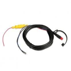
Related products


Reviews
There are no reviews yet.